Earthquakes
Objective
This project, created in the university course "Datenvisualisierung" aims to provide an engaging and exploratory experience focusing on the dynamics of earthquakes on a global scale, with a specific focus on Antarctica, particularly The Balleny Islands region. The goal is to develop a comprehensive understanding of seismic phenomena through detailed infographics and maps.
Content
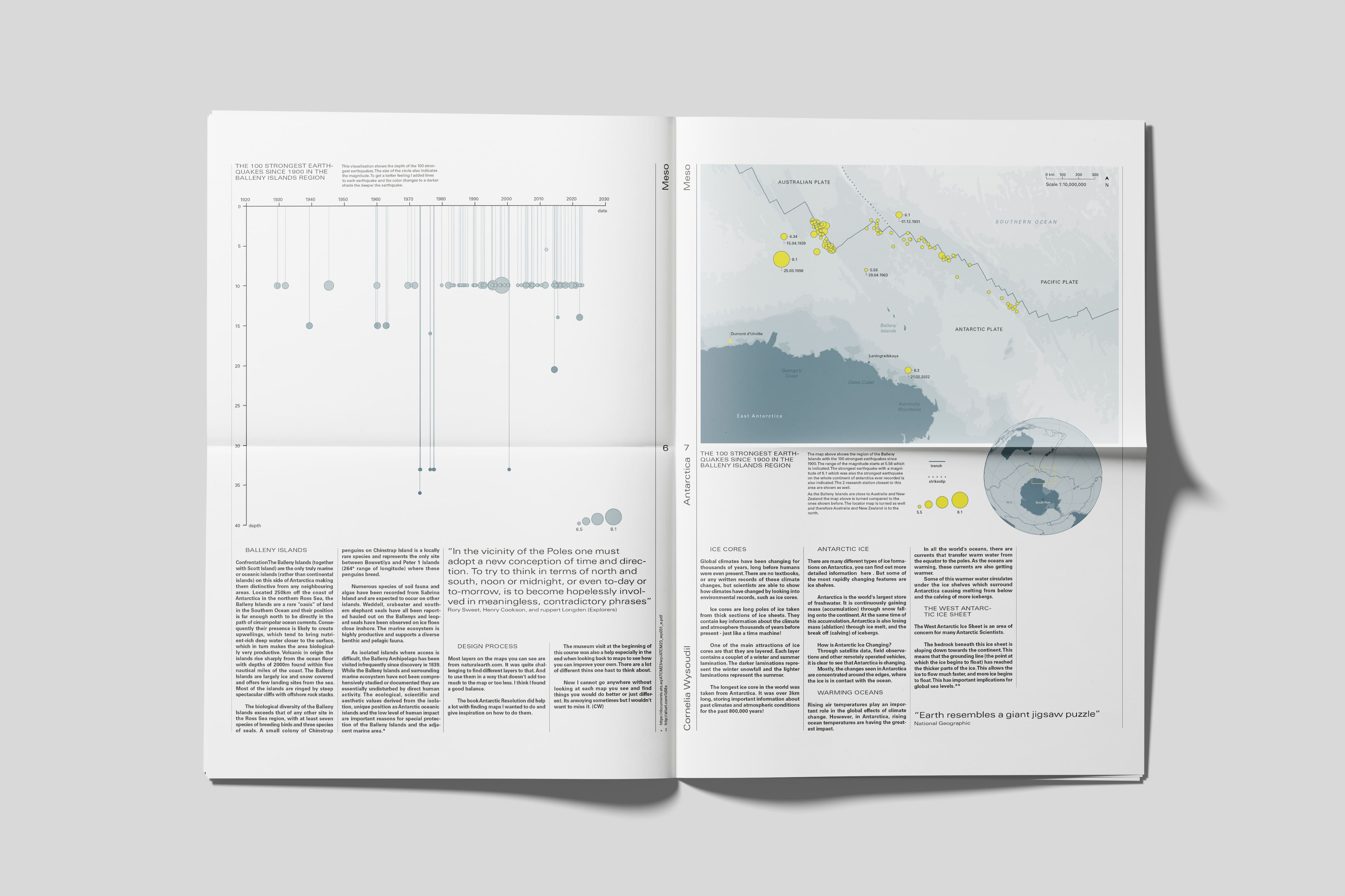
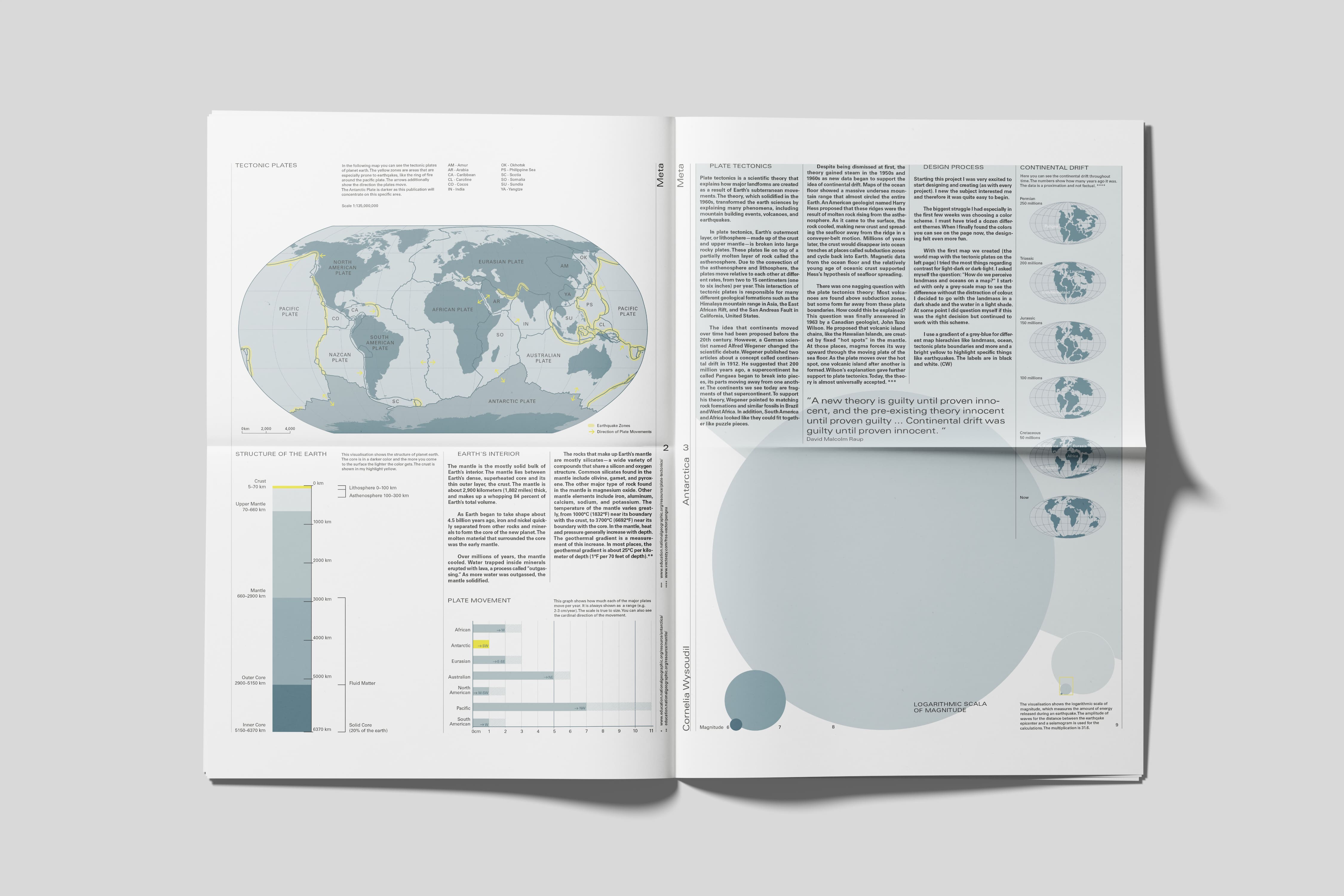
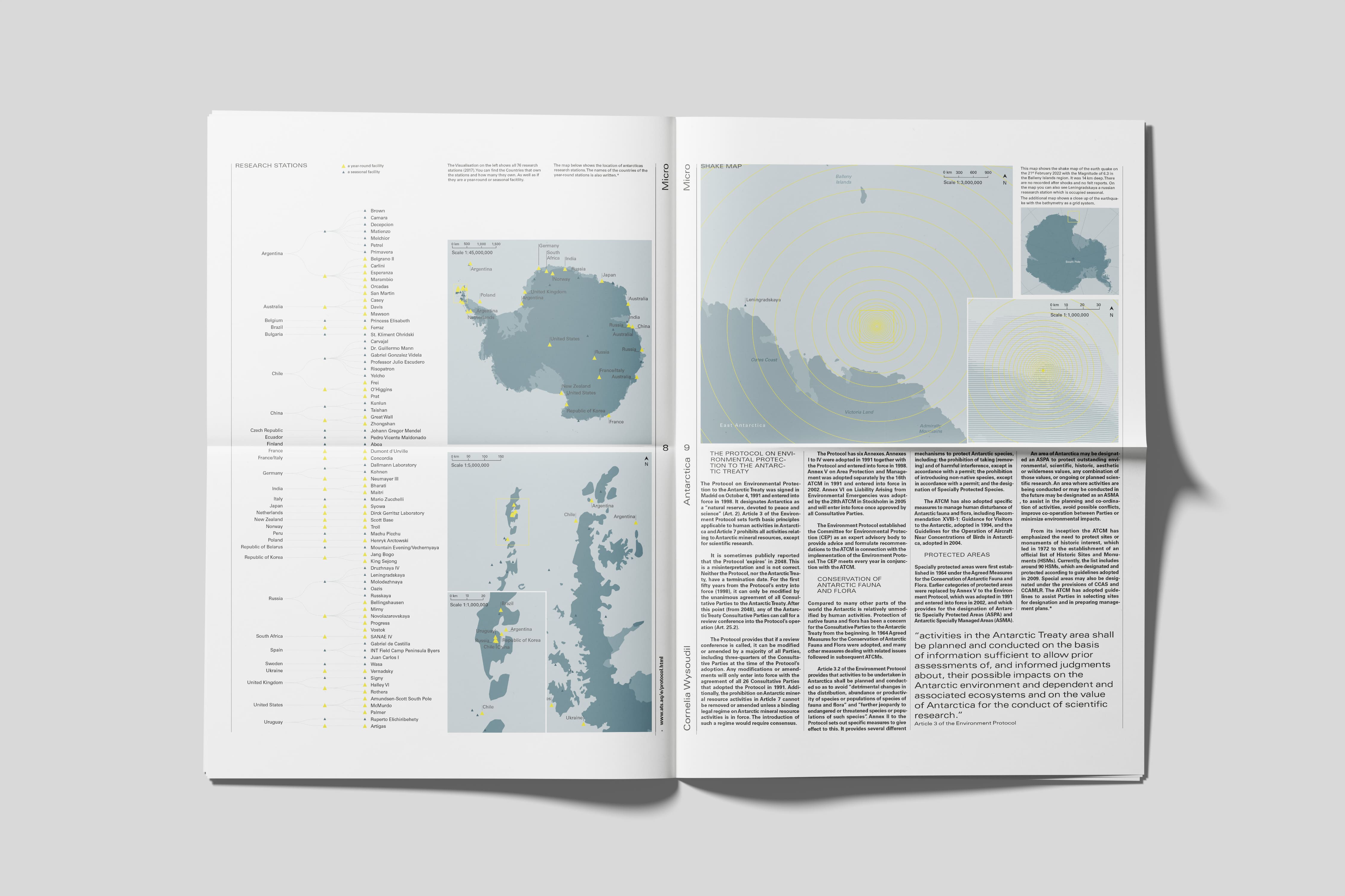
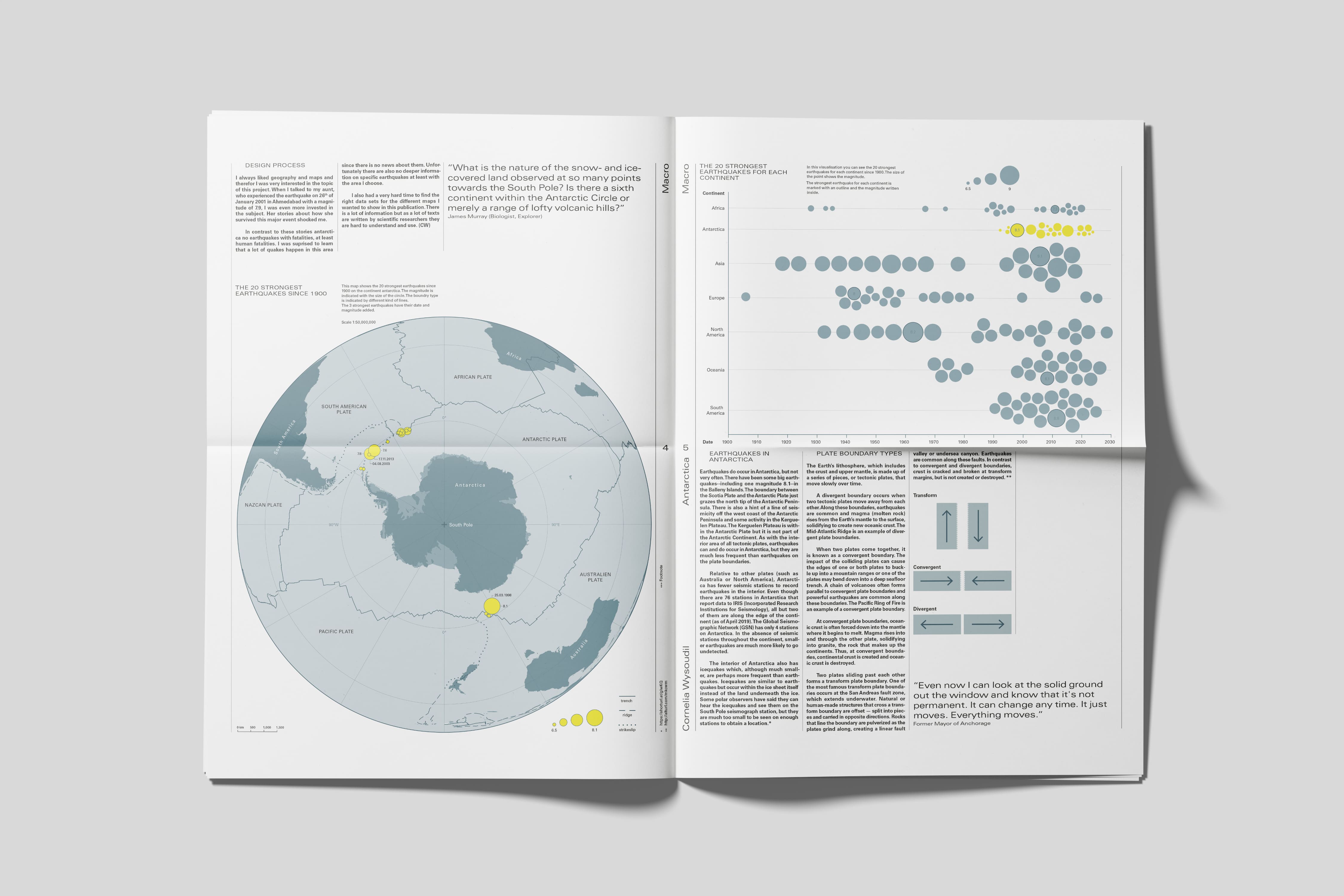
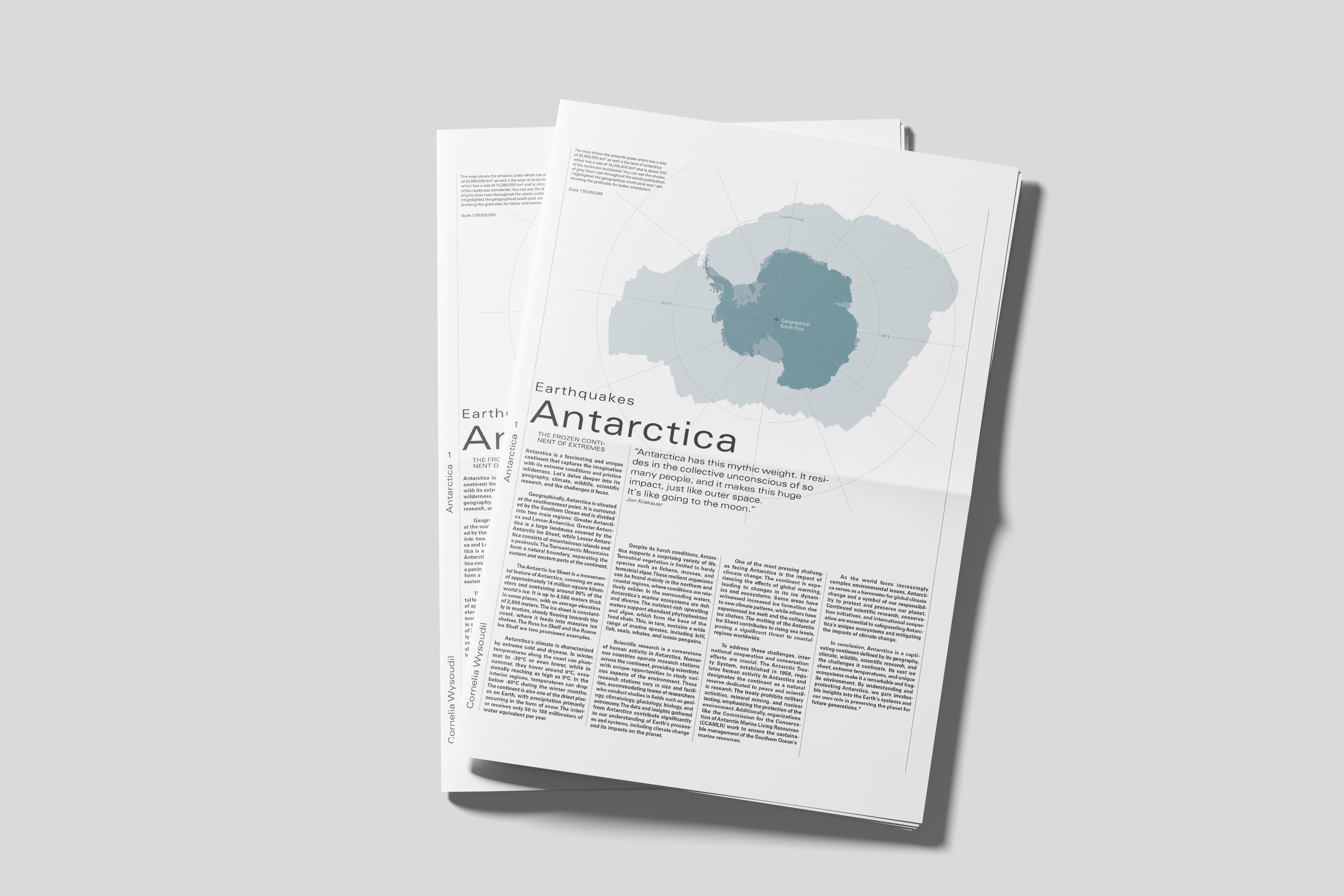
A visual study on earthquakes in Antarctica, this paper represents the culmination of a three-month university project. Spanning 10 pages, the content unfolds across four levels—meta, macro, meso, and micro—each delving deeper into the seismic phenomena. At the meta level, a global perspective is provided, presenting an overview of tectonic plate phenomena. The macro level focuses on the 20 most powerful earthquakes in Antarctica since 1900. The meso level explores the intricate seismic activities of The Balleny Islands region, while the micro level examines a specific earthquake in the region that occurred on February 21, 2022.
Implementation
For this project, I participated in a collaborative effort where the class was divided into seven groups, each representing a continent. Within these groups, individuals chose specific regions and earthquakes to visualize. My focus was on The Balleny Islands region in Antarctica. Through detailed infographics and maps, the project aimed to simplify access to complex seismic data and provide a clearer understanding of earthquake phenomena.
Data visualization | Infographic design | Geological Research | Editorial Design | Collaborative Work
This project in its entirety won bronze in the *EDAWARDS (European Design Awards)
> WINNER - Global Earthquake Atlas